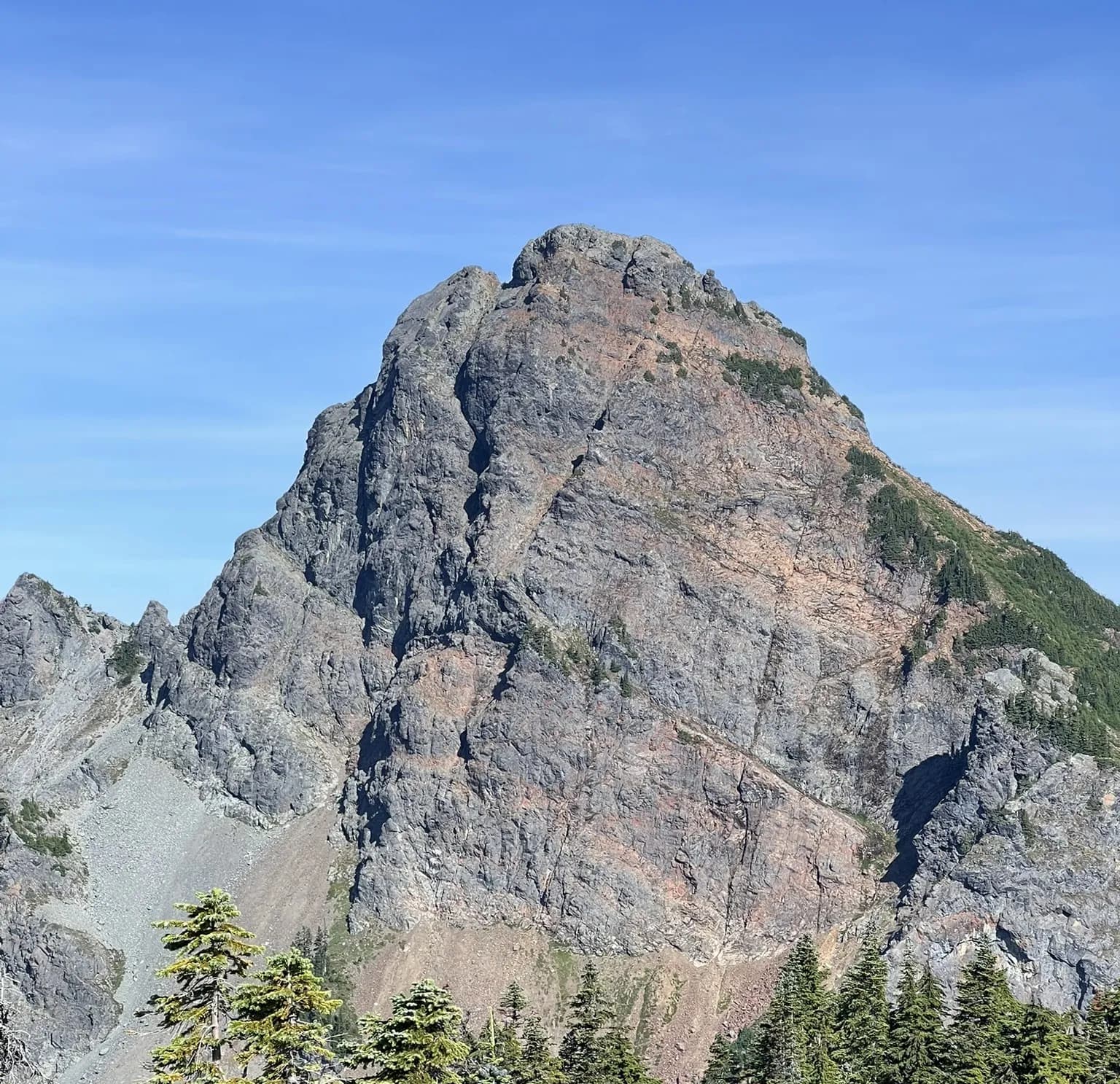
A prominent bell shaped mountain in greater Snoqualmie Pass region
3 days Snoqualmie Pass North Traverse trip report
From Snoqualmie Pass, follow the Pacific Crest Trail north for about 7.5 miles to Ridge Lake, where most parties camp. From camp, continue a short distance north on the PCT to the base of Bumblebee Pass. A well-defined steep boot path leads up to the pass.
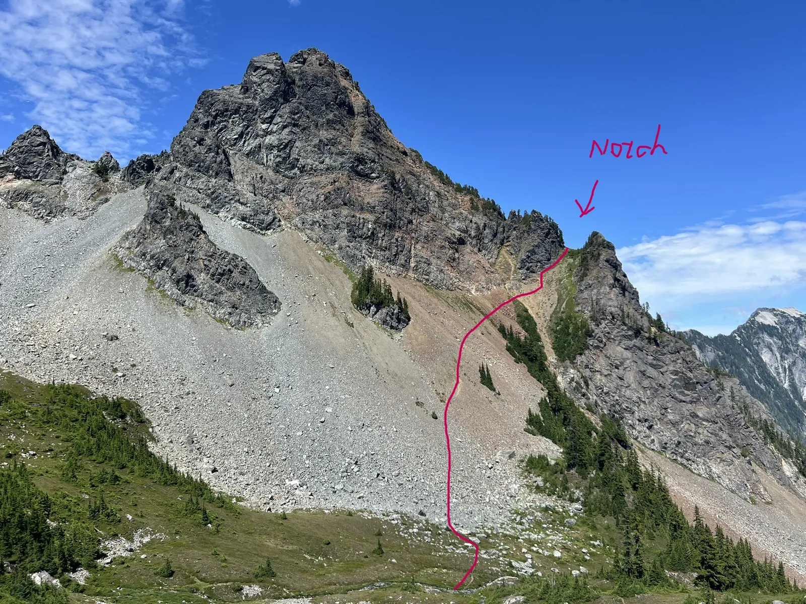
From the top of Bumblebee Pass, drop slightly into the basin and work across talus and scree toward a U-shaped notch. A boot path guides much of the way. Beyond the notch, continue following the path as it winds toward the summit ridge. Staying on the route keeps the climbing to class 3. If you find anything harder, there's likely an easier way around.
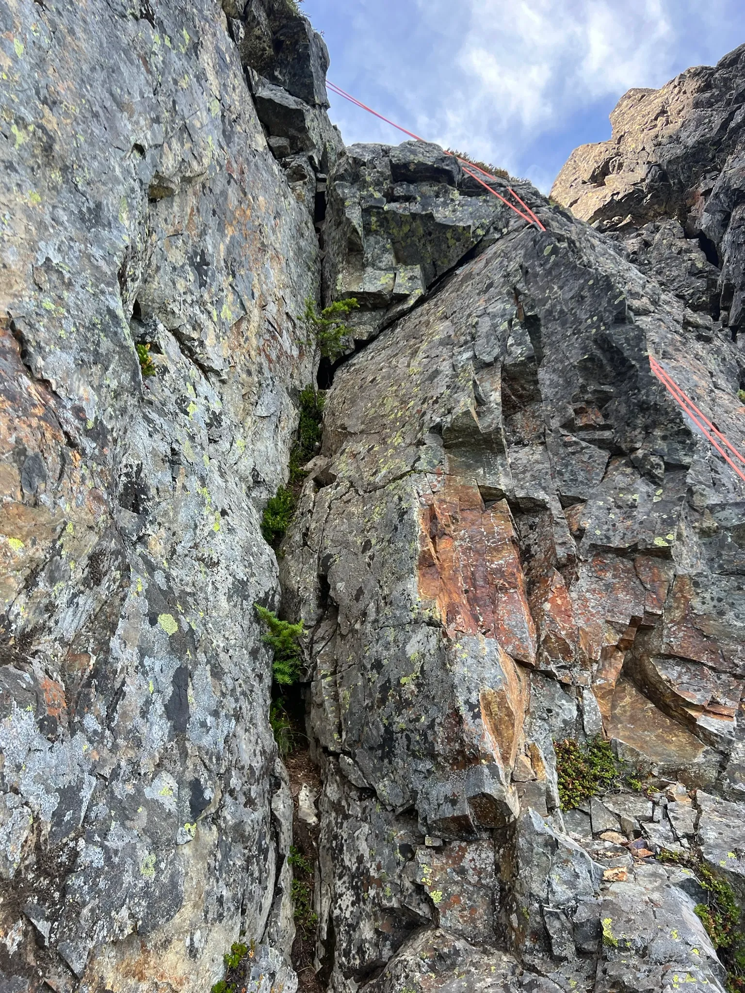
Just below the summit lies the crux, a stiff 20 ft class 4 dihedral. We solo it in rock shoes, though a handline can help anyone less comfortable. From the top of the dihedral, it's an easy scramble to the summit.
For the descent, we rappel the dihedral from an established station just above the crux. There's another station at the base, but we don't use it since we're not sure where it leads, and the terrain below isn't hard enough to need a second rappel.
Chutang and I planned a three-day traverse north of Snoqualmie Pass, following the PCT Section J to the Mineral Creek trailhead. Along the way, we climbed three Snoqualmie Peaks, two of which are also Smoot peaks: Mount Thompson, Huckleberry Mountain, and Chikamin Peak.
We left a car at the Mineral Creek trailhead and spent Thursday night, 08/07, at a nearby campground. On Friday morning, we drove to the Snoqualmie Pass PCT north trailhead and started hiking at 7:41 AM toward Ridge Lake. The hike along the PCT was pleasant, but Section J is busy even on a Friday morning, with plenty of hikers sharing the trail.
It took us about 4 hours and 30 minutes to reach Ridge Lake and Gravel Lake. We kept a steady pace with a few breaks to enjoy the views and take photos. Carrying climbing gear for Huckleberry Mountain made our backpacks heavier.
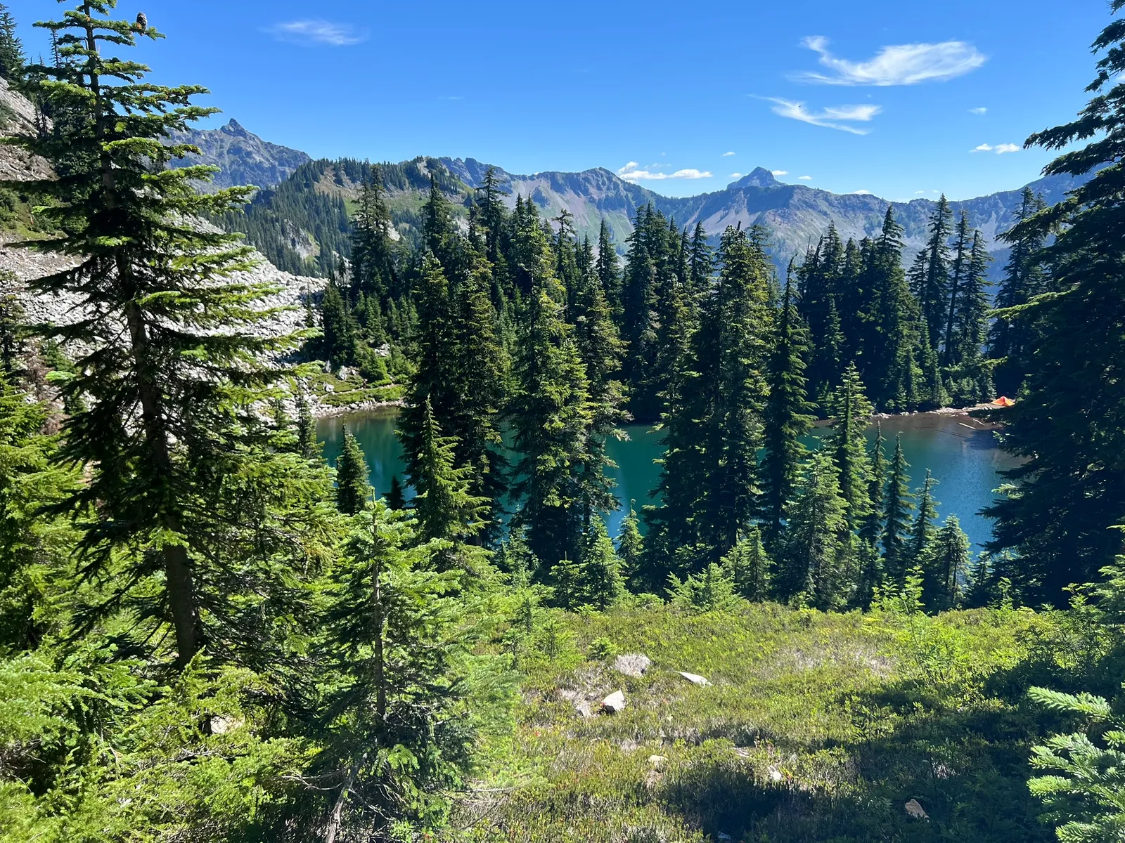
At Ridge Lake, we found two tents already set up, so we chose to camp on the Gravel Lake side, where there are many established campsites. We were the first there, but by the time we returned, I counted over ten tents around the lakes.
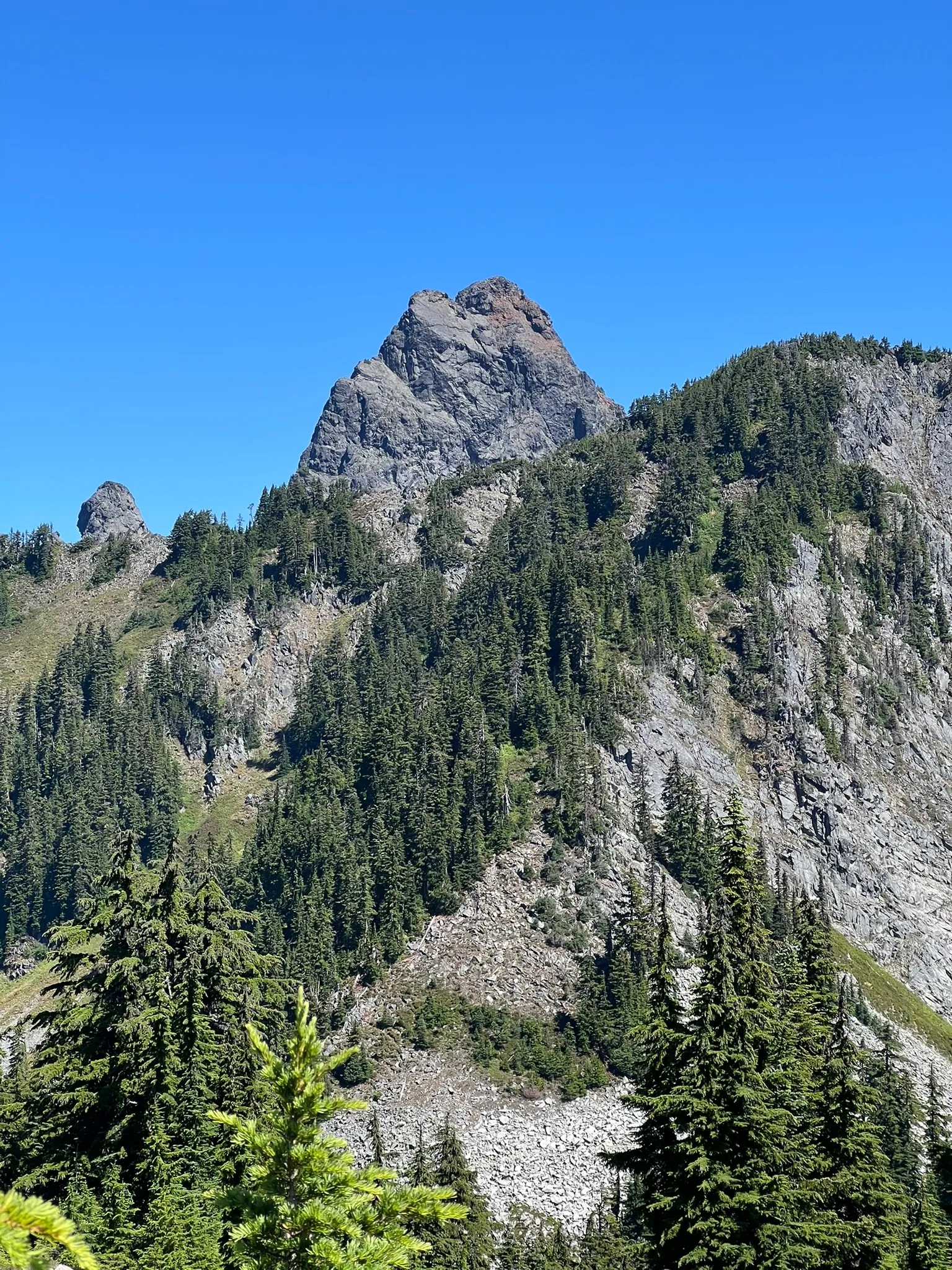
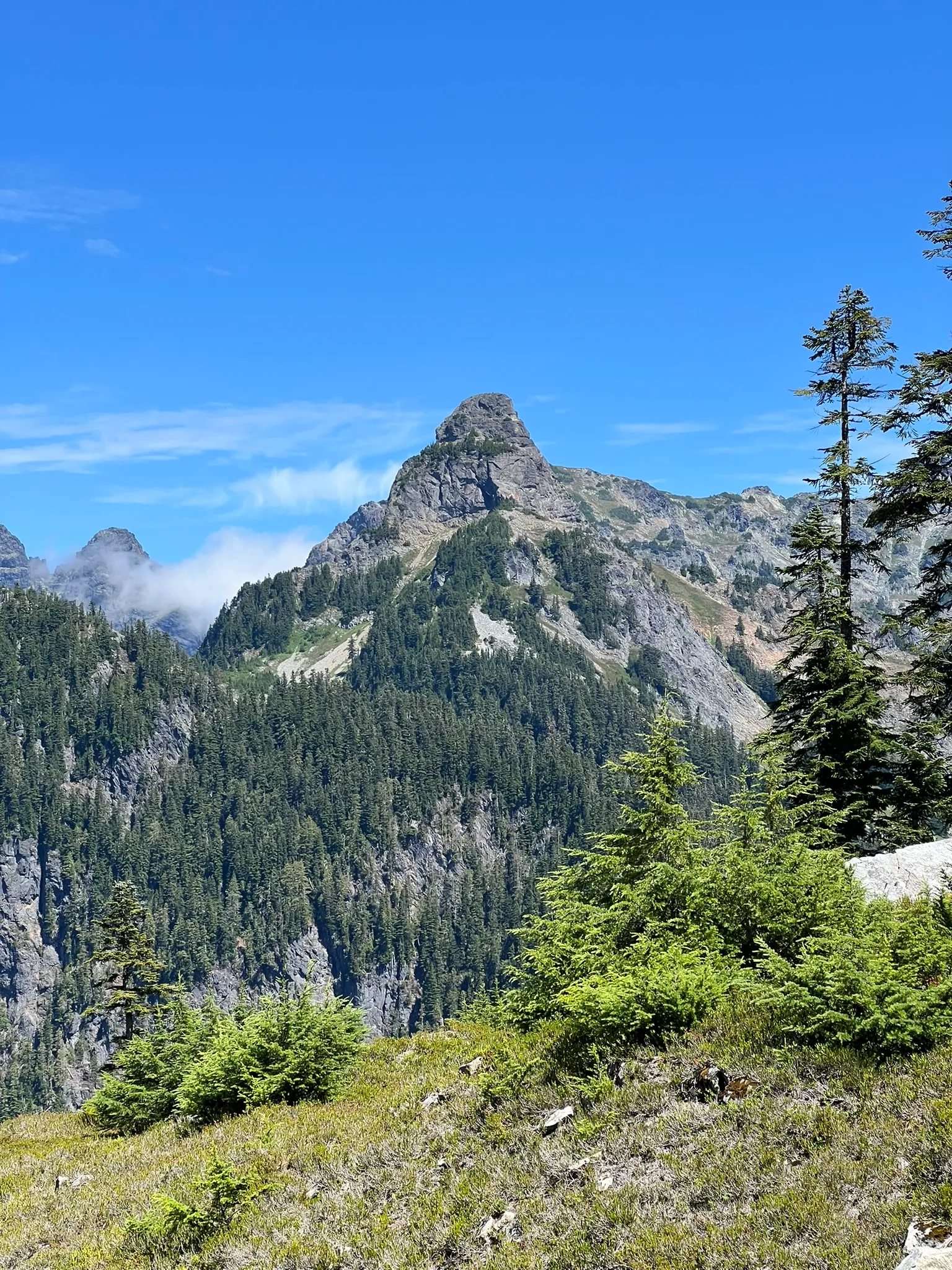
After setting up our tent and hanging our food, we headed toward Mount Thompson. A short 0.4-mile walk brought us to the foot of Bumblebee Pass. The trail fork wasn’t very obvious, but GPS made it easy to find. From there, a steep trail led to the top of the pass, where both Chutang and I were amazed by how massive and rugged Mount Thompson looked.
We descended into the basin and climbed through talus and scree to reach a U-shaped notch. Most of the route had an obvious boot path. After the notch, we followed the path toward the summit, but occasionally lost it and had to make some class 3-4 moves. On the way down, we realized that if you stay on route, nothing is harder than class 3. If you find something harder, there's likely an easier way around.
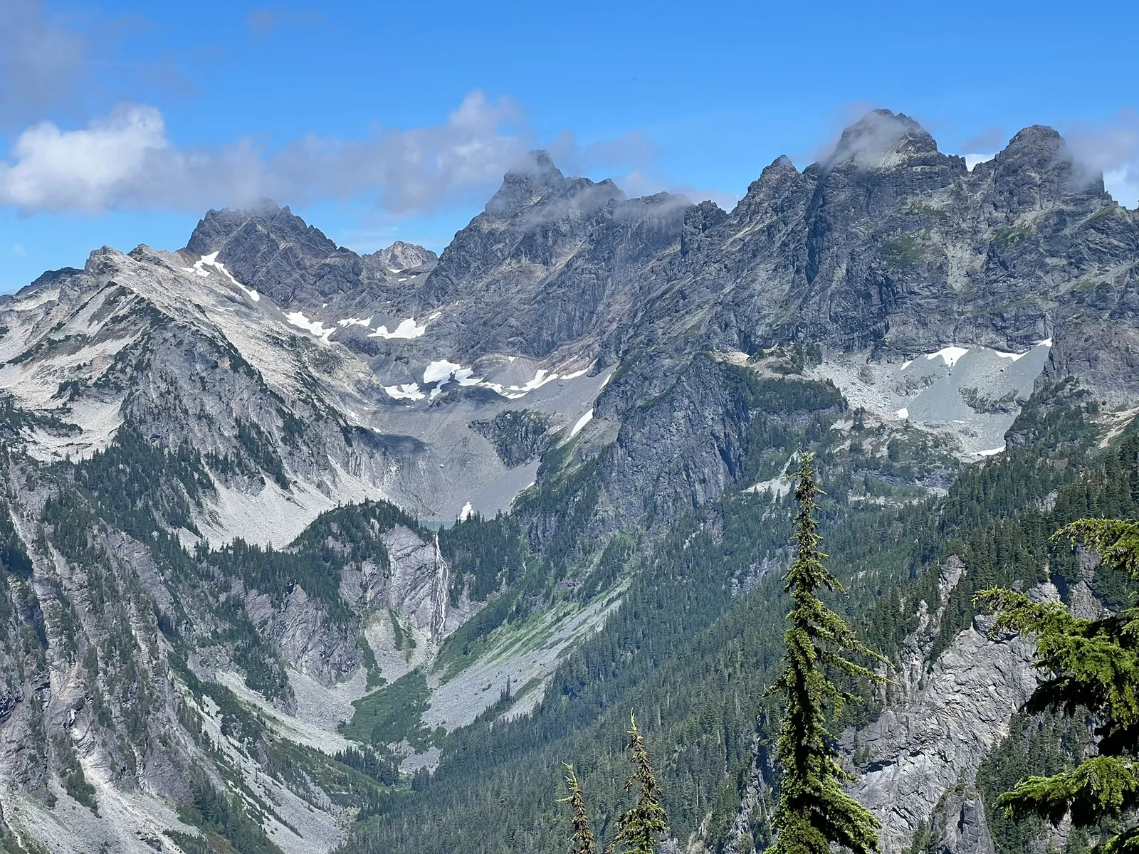
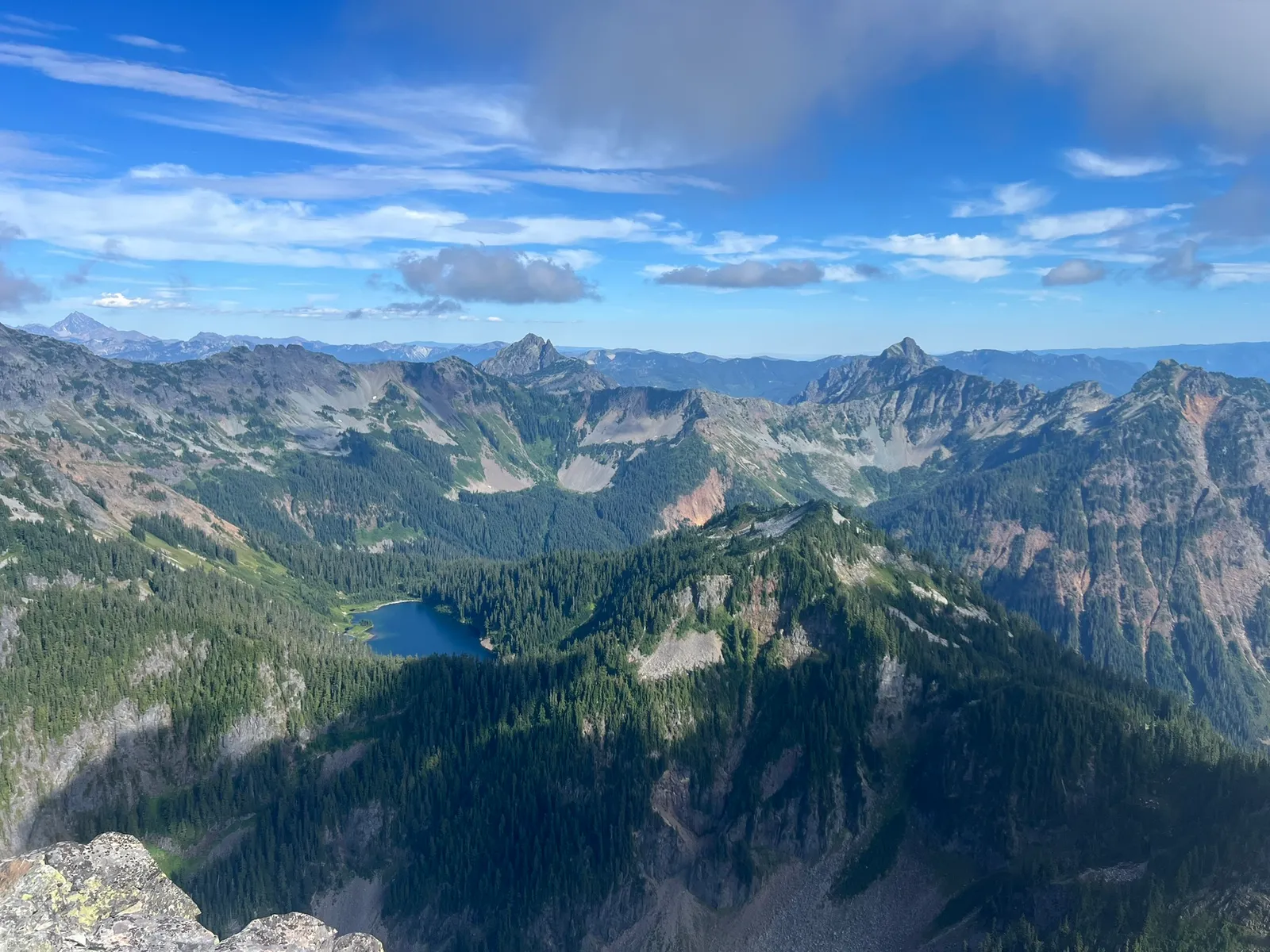
The crux was a 20-foot class 4 dihedral just below the summit. We changed into climbing shoes and soloed it. For less experienced climbers, a handline would help. The summit offered a 360-degree view of the Snoqualmie Pass area, and we found a register and pen at the top.
After enjoying the view, we started descending. We did a short rappel using fresh webbing on the anchor just above the crux. Thanks to whoever recently added it! There was another rappel station below the dihedral, but we didn’t use it since we weren’t sure where it went, and the rest of the descent was class 3 or easier anyway.
The whole round trip from camp took about six hours. We got back to camp around 7 PM, and I took a quick dip in Ridge Lake, where the water was surprisingly mild and refreshing!